Beaufort, Francis Sir (Hydrographer)
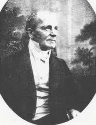
Rear-Admiral Sir Francis Beaufort, KCB, FRS, FRGS was an Irish hydrographer and officer in Britain's Royal Navy. Beaufort was the creator of the Beaufort scale for indicating wind force.

He was born in Navan in 1774,
he was the son of the Rector Daniel Beaufort.
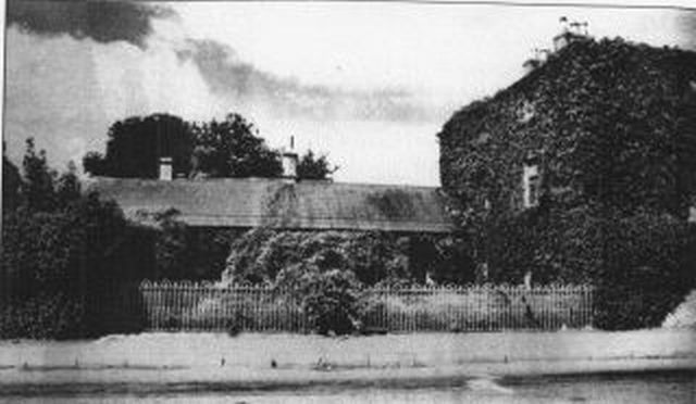
Below is the family home,
Beaufort House,
which was demolished to make way for a new road.
It was located at the top of Flower Hill Navan.

In 1787, aged 13, he joined the Navy and served in the Napoleonic Wars. He was wounded near Malaga in 1800.
During his recovery he helped his brother in law Richard Lovell Edgeworth to set up a telegraph line from Dublin to Galway in 1803-1804.
He was wounded again after returning to active service in the Navy, this time he was injured near Turkey in 1812.
From 1829-1855 he was Hydrographer to the Navy, and published a survey entitled; Karamama or a brief description of the South Coast of Asia Minor (Turkey) and of the Remains of Antiquity.
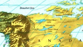
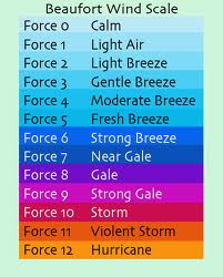
He invented The Scale of Wind Velocities (Beaufort Scale) in 1806 which was named after him, as was the Beaufort Sea (below)


He received the KCB in 1848 for his civil achievement.
Sir Francis died in London on 17 December 1857, and is buried in the church of St. John-in-Hackney.
*******
The article below is by Brendan MacWilliams
from the Irish Times, 12 August 1995
The fanciful geographers of antiquity pictured the world as a single interconnected landmass bordered by a vast expanse of unnamed, unchartered water. Two thousand years later, the maps available to seafarers were still, at best inadequate, and at worst a real source of danger to the user.
The French navigator Cassini put it around 1770:
“It is better to have absolutely no idea where you are, and to know it, than to believe confidently that you are where you are not.”
But matters improved in the second half of the 18th century – mainly because of two factors; the invention of the chronometer allowed the accurate measurement of time at sea, and thus precise estimation of longitude; and new techniques of triangulation from fixed points ashore allowed charts for coastal regions to be compiled with much more accuracy than before.
A third development, which occurred 200 years ago today, was a direct result of this new-found confidence in responding to a need. On August 12th 1795 an Order in Council signed by King George III established the Hydrographic Office of the Admiralty, a body which was to become renowned for producing the most trusted navigational documents available to seafarers for any quarter of the globe.
The high reputation of the Hydrographic Office was largely due to the effort of one man, an Irishman from Co. Meath. Admiral Sir Francis Beaufort – better known, perhaps as the originator of the Beaufort Scale of Wind Force – was the fourth hydrographer to head the office, and he had a lengthy term lasting from 1829 to 1855.
His obsession with accuracy was allegedly a direct result of his being shipwrecked as a boy because of faulty maps. As Hydrographer to the Royal Navy, Beaufort worked tirelessly at organizing surveying expeditions and meticulously collating their findings with a combination of artistic skill and mathematical ability. Through his efforts, coastlines in all corners of the world were chartered with precision, harbour soundings were documented, sea routes were mapped out and the directions of auspicious winds were carefully compiled.
The first Admiralty Tide Tables appeared in 1833, and the first notice to Mariners the following year. By the time he retired in 1855, Beaufort had increased the number of standard charts available to mariners from a few hundred to nearly 2,000. The hydrographic office, before his time no more than a storage room for mediocre maps, had become a highly respected scientific institution, noted throughout the world for charts of unsurpassed accuracy and detail.
*******
Stephen Flanagan,
‘Legends of Irish Life: No. 19: Francis Beaufort’, Magill (May 2003), pp.14-15:
‘Francis Beaufort was destined to go to sea from the age of four. But as he crouched low in a small boat one night in 1800, two loaded pistols in his lap, heading from his ship towards a hostile Spanish craft, he must have wondered if the ocean gods had also prescribed him an early grave. The idea was to slip quietly up to the side of the Spanish ship under the cover of darkness and board it. But it was not to be - Beaufort’s craft was spotted, and a flare went up illuminating the scene. Another ship opened fire with muskets. Beaufort and his companions reached the side of the Spanish vessel and began to scramble up. One seaman was shot through the throat. Beaufort came over the side and was immediately cut twice by a cutlass, once on the head and once on the shin. He struggled on, only to be shot from point blank range with a blunderbuss. By chance he had partially turned away to check the rest of his crew, and the blast ripped into his chest and left arm. Beaufort somehow fought on. Then, just as it looked as though they had won, he was shot for a second time, in the side. His last orders were to cut the mooring cables before he lost consciousness.
On 13 January 1806, he wrote in his journal: “Hereafter I shall estimate the force of the wind according to the following scale, as nothing can convey a more uncertain idea of wind and weather than the old expressions of moderate, cloudy, etc. He then explained his wind scale, with graduated descriptions such as “gentle breeze”, “moderate breeze”, “fresh breeze” and so on. The scale, however, wasn’t original. It was based on a version written in 1789 by English hydrographer Alexander Dalrymple, although Beaufort had expanded the concept significantly, paving the way for the contemporary scale that bears his name.
Source: www.ricorso.net/rx/az-data/authors/b/Beaufort_F/life.htm