Navan to Athboy
Source:
The Boyne Valley in the Ice Age, Robert T. Meehan & William P. Warren
The Geological Survey of Ireland
Take the old Athboy Road past Navan Hospital. Before turning left, crossing the railway bridge, a high hill looms on your right. This is Navan Moat an early Norman fortified site. The moat, or motte, is built on a moraine which was deposited at the ice front when it stabilised at Navan for a short period during the last deglacial period.
The Normans were adept at modifying hills such as this to provide a palisaded hilltop defensive site pending the construction of a castle. The hill itself is composed of layers of till and sorted gravels. Till is sediment deposited by or from glacier ice; unsorted and unstratified, and generally tightly packed. Gravel is a sediment with a particle size over 2 mm.
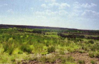
The flat area west of the moat towards Athboy which extends for several kilometres west of Navan is a flat till plain. Tara Mines/Boliden can been seen to the north on the Bohermeen Road. Here the limestone bedrock beneath the till is intensely faulted and folded and has resulted in the mineralisation of lead and zinc along many of the major joints. The limestone is overlain by several metres of the till which comprises the till plain. The till gives rise to thick topsoils which provide almost perfect conditions for pastoral farming.
Past Halltown Cross Roads where there is signpost for Dunderry on the left, the flat area is underlain by marl deposits which were deposited into a temporary glacial lake. Marl is a soil consisting of clay and carbonate of lime, a valuable fertiliser.
Tullaghanstown Bog
 The bog starts where the road sign warns of subsiding road surfaces. The bog covers an area of about 5 square kilometres and in some places is over 10m deep.
It is an excellent example of a
Midland Raised Bog
where the surface of the peat rise from the margins to the centre forming a dome.
Peat formation began almost immediately following the last glaciation about 10,000 years ago. Tullaghanstown Bog formed here in a wide flat basin which had held a glacial lake as the ice sheets melted and which was floored by glaciolacustrine clays. These clays pertain to lakes made up of meltwater from glaciers or ice sheets. In the early postglacial period there would have been a shallow lake here. As the vegetation ( aquatic plants in the lake water and semi aquatics near the shore) died and accumulated in the basin, it began to form peat. This decreased water depth and resulted in the gradual encroachment of vegetation into the lake and a fen was established.
As the margins of the fen became invaded by reedswamp plants and bulrushes, and as other submerged plants established themselves in shallow waters, the accumulating vegetable debris eventually consolidated into fen peat, which continued its build up as time went on. As the peat further accumulated and the bog rose above the surrounding area above the influence of the mineral soil the vegetation changed and it became a raised bog with a very different vegetative cover dominated by sphagnum moss. This moss has a remarkable capacity for capturing and storing rain water and is generally considered as the primary building block for the growth of peat bogs. Peat in an undisturbed bog is composed more than 90% of water. The rest is dead vegetative matter. Thus a bog contains less solid matter and more water than milk, yet it is possible to walk on it.
On close inspection branches, twigs, leaves and moss can be clearly seen in the peat and it is these that tell us how the bog formed. Many of the fields along the road just past the main peat area were once part of the bog also, but at some of these locations the peat has been largely removed for fuel over the last two centuries.
Past the bog and as far as the Hill of Ward the road crosses a till plain. Around Rathmore, where the church and school are, there is an old church on the left. The land is very well drained as the underlying till is especially gravelly, and water can percolate through it with ease.
Turn left in Athboy for the Hill of Ward. The Hill of Ward is cored by limestone bedrock which is very close to the surface at its summit. The bedrock has been eroded and shaped into a dome shaped hill by the movement of ice from northwest to southeast during the last glaciations. At the northwest side of the crossroads close to the summit there exists an old, disused quarry cut into the limestone. The quarry exposes folded beds of limestone which have been sheared at the top by ice, truncating the folds. On the sides of the hill a thin covering of lodgement till has been deposited on the bedrock. The view from the top of the hill shows the plain of central Meath with sporadic high hills, such as Tara to the east, protruding above the till plain. To the west the bogs of Westmeath can be seen in the distance.